Footnotes: (applicable only where specifically marked above)
** Arrival dates earlier than the online-reservation-window may also be available at the campground.
*** Some sites may be available only from the campground on a first-come-first-served basis.
 Pennsylvania State Parks and Forests Reservations


Bald Eagle State Forest, PA
Description
Bald Eagle State Forest, named for the famous Native American Chief, Bald Eagle, includes 194,602 acres in Snyder, Union, Centre, Mifflin, and ...[more]
Book a Campsite at Bald Eagle State Forest, PA
Overview
Description
Bald Eagle State Forest, named for the famous Native American Chief, Bald Eagle, includes 194,602 acres in Snyder, Union, Centre, Mifflin, and Clinton Counties.
For more information visit the Bald Eagle State Forest website and Facebook Page
Geography: wThis state forest spans the high, sharp ridges of central Pennsylvania and features miles of pristine mountain streams and numerous tracts of old-growth forest.
Bald Eagle forest district lies in the beautiful ridge and valley section of the state. From the limestone-rich Susquehanna Valley in the southeast to the Allegheny Mountains in the northwest, the forest district is dominated by a series of sandstone ridges, some of which reach 2,300 feet above sea level.
The confluence of the west and north branches of the Susquehanna River occurs on the eastern boundary of the district, opposite the town of Northumberland. Many streams within the area originate in its forested ridges and flow in several directions, eventually emptying into the Susquehanna River.
Recreation: wThe Bald Eagle’s expansive forests offer limitless recreational opportunities. Hikers, bikers, and horseback riders alike will find over 300 miles of trails to explore. Just a few highlights include the old-growth forest of Snyder-Middleswarth Natural Area, the large, remote and undeveloped Hook Natural Area, and the Stony Run Forest Demonstration Area. There are 26 vistas throughout the forest that overlook the stunning valleys.
Hunters and fishermen will find rewarding opportunities in the nearly 200,000 acres of forest where there are numerous fishable streams including the acclaimed Penns Creek and White Deer Creek.
For those with an interest in motorized recreation, the Bald Eagle offers 20 miles of ATV trails, as well as dual sport motorcycle and off-highway motorcycle trails. In the winter there are over 250-miles of state forest roads and trails open for snowmobiling.
Families can picnic at the four State Forest Picnic Areas and at other trailhead locations where picnic tables and grills are offered.
Camping in the Bald Eagle State Forest is a great way to get away from it all and spend a night in the great outdoors. The designated, roadside campsites are identified by signpost with campsite number. They are remote, designated sites with no amenities other than a fire ring and picnic table
For trail maps and more visit the Bald Eagle State Forest Map web page.
Facilities: wThe Bald Eagle State Forest is managed primarily for dispersed recreation and facilities are limited. The several State Forest Picnic Areas offer the most improvements including pavilions, picnic tables, grills, and restrooms. Trailheads and parking are available throughout the forest. The designated, roadside campsites offer no amenities other than a picnic table and fire ring.
Nearby Attractions: wBald Eagle State Park, Poe Paddy State Park, Poe Valley State Park, RB Winter State Park, Reeds Gap State Park
"Geography:
This state forest spans the high, sharp ridges of central Pennsylvania and features miles of pristine mountain streams and numerous tracts of old-growth forest.
Bald Eagle forest district lies in the beautiful ridge and valley section of the state. From the limestone-rich Susquehanna Valley in the southeast to the Allegheny Mountains in the northwest, the forest district is dominated by a series of sandstone ridges, some of which reach 2,300 feet above sea level.
The confluence of the west and north branches of the Susquehanna River occurs on the eastern boundary of the district, opposite the town of Northumberland. Many streams within the area originate in its forested ridges and flow in several directions, eventually emptying into the Susquehanna River.
Recreation:
The Bald Eagle’s expansive forests offer limitless recreational opportunities. Hikers, bikers, and horseback riders alike will find over 300 miles of trails to explore. Just a few highlights include the old-growth forest of Snyder-Middleswarth Natural Area, the large, remote and undeveloped Hook Natural Area, and the Stony Run Forest Demonstration Area. There are 26 vistas throughout the forest that overlook the stunning valleys.
Hunters and fishermen will find rewarding opportunities in the nearly 200,000 acres of forest where there are numerous fishable streams including the acclaimed Penns Creek and White Deer Creek.
For those with an interest in motorized recreation, the Bald Eagle offers 20 miles of ATV trails, as well as dual sport motorcycle and off-highway motorcycle trails. In the winter there are over 250-miles of groomed snowmobile trails.
Families can picnic at the four State Forest Picnic Areas and at other trailhead locations where picnic tables and grills are offered.
Camping in the Bald Eagle State Forest is a great way to get away from it all and spend a night in the great outdoors. The designated, roadside campsites are identified by signpost and campsite name. They are remote, designated sites with no amenities other than a fire ring and picnic table
For trail maps and more visit the Bald Eagle State Forest Map web page.
Facilities:
The Bald Eagle State Forest is managed primarily for dispersed recreation and facilities are limited. The several State Forest Picnic Areas offer the most improvements including pavilions, picnic tables, grills, and restrooms. Trailheads and parking are available throughout the forest. The designated, roadside campsites offer no amenities other than a picnic table and fire ring.
Nearby Attractions:
Bald Eagle State Park, Poe Paddy State Park, Poe Valley State Park, RB Winter State Park, Reeds Gap State Park
Booking Window
Roadside
Fri Jun 28 2024 - Tue May 27 2025Reservations can be made for today and can be made up to 11 Month(s) in advance.
Roadside Hike-in
Fri Jun 28 2024 - Tue May 27 2025Reservations can be made for today and can be made up to 11 Month(s) in advance.
Season Dates
Season Schedule
Park Season
Start
End
Peak
Mon Jan 01 2024
Tue Dec 31 2024
Peak
Wed Jan 01 2025
Wed Dec 31 2025
Services and Amenities
Within Park
- Bird Watching
- Camping, Backcountry
- Camping, Primitive
- Canoeing
- Fishing
- Hiking
- Hiking Trail
- Hunting
- Kayaking
- Mountain Biking
- Mountain/Trail Bicycling
- Picnic Area
- Picnic Pavilion
- Picnicing
- Scenic Driving Routes
- Stargazing
- Trails, Mountain Bike
- Wildflower Viewing
- Wildlife Viewing
- trails - equestrian
Getting There
GPS Info. (Latitude, Longitude):
40.90307, -77.21401
40°54'11"N, 77°12'50"W
40.90307, -77.21401
40°54'11"N, 77°12'50"W
The State Forest Resource Management Center is centrally located in the forest district.
From US-15, take PA-45 W in Lewisburg and continue 17.6 miles to the office on left.
From US-322, which can be easily accessed from I-99 or I-80, take PA-45 E for 39 miles to the office on right.
GPS: 40°54'26.4 N 77°12'41.7 W


Nearby Parks

[6.17 miles*]

[11.75 miles*]

[14.19 miles*]
Connect
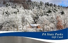
Gift Cards